Fast & Reliable Stockpile Measurement App for Field Operations

Fast & Reliable Stockpile Measurement App for Field Operations

Fast & Reliable Stockpile Measurement App for Field Operations

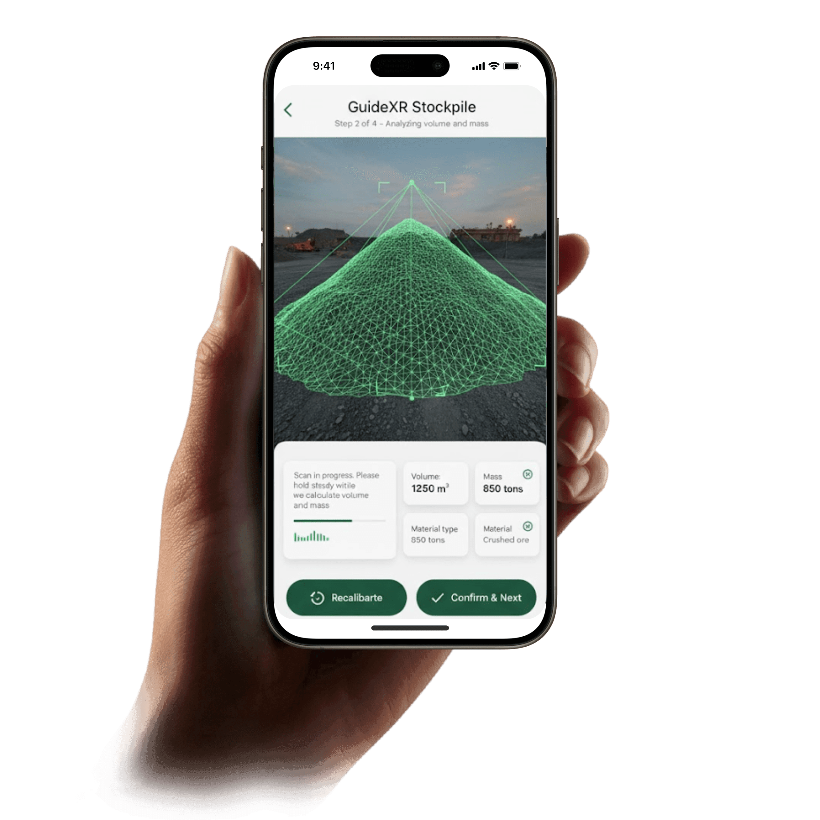
GuideXR Stockpile is a mobile-first stockpile measurement app built for remote mining and aggregate sites. Capture, process, and verify stockpile volume measurements in near real-time using just your phone, no GPS, no drones, no extra survey equipment required.


GuideXR stockpile measurement app
Real-time scanning feature
Stockpile scanning app interface
AR stockpile scanning
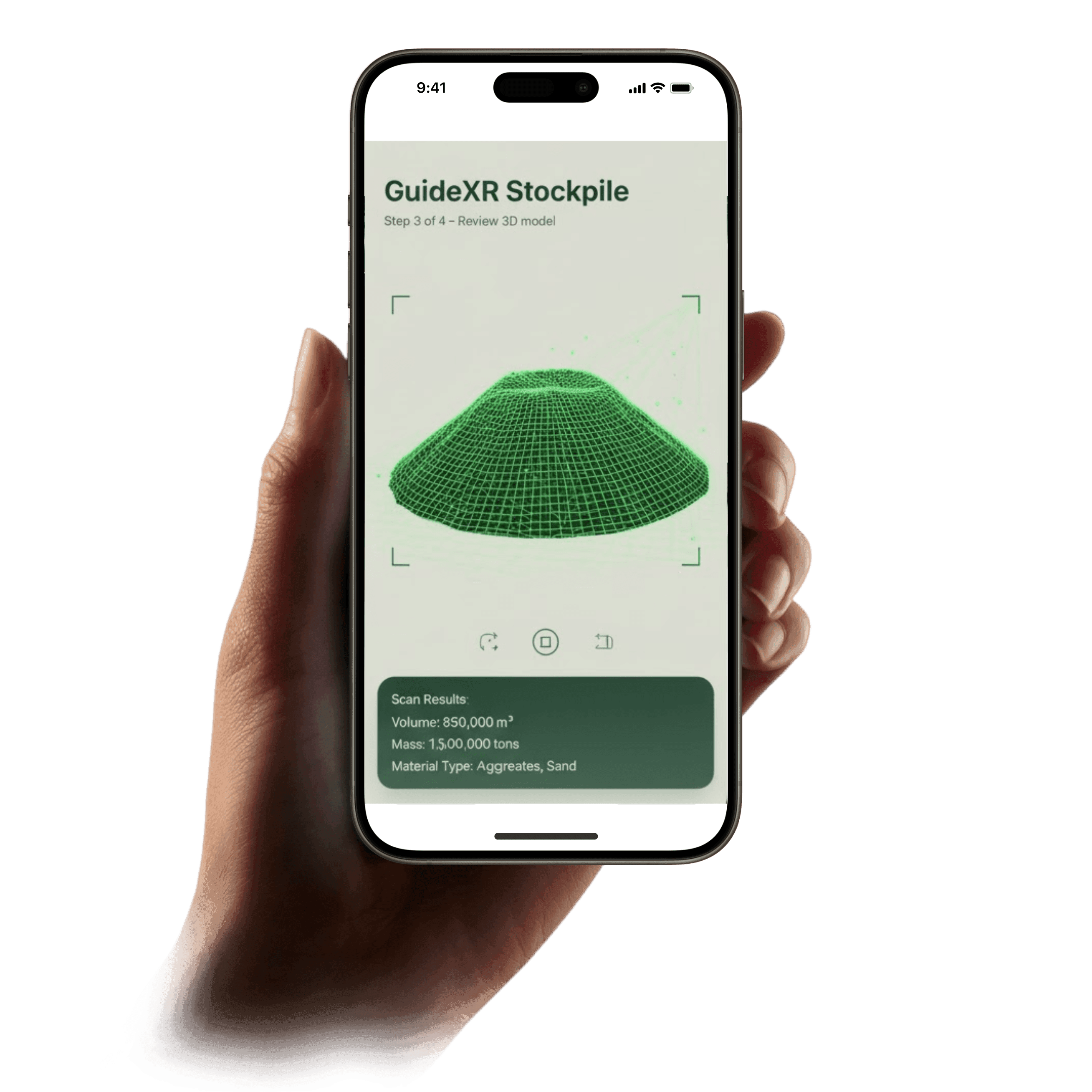
Stockpile volume estimation
Stockpile volume measurement

No Network Coverage.

No problem.

No Network Coverage.

No problem.

No Network Coverage.

No problem.

GuideXR Stockpile enables offline stockpile volume measurement using advanced mobile scanning technology. Scan a pile in just 5–10 minutes and automatically sync data when connectivity is restored.

GuideXR Stockpile enables offline stockpile volume measurement using advanced mobile scanning technology. Scan a pile in just 5–10 minutes and automatically sync data when connectivity is restored.

What Makes GuideXR Stockpile Unique?

What Makes GuideXR Stockpile Unique?

What Makes GuideXR Stockpile Unique?

What Makes GuideXR Stockpile Unique?

Mobile-First AR-Based Stockpile Measurement

Mobile-First AR-Based Stockpile Measurement

Capture detailed stockpile geometry using your smartphone or tablet with real-time spatial guidance, enabling fast and accurate stockpile volume estimation.

Capture detailed stockpile geometry using your smartphone or tablet with real-time spatial guidance, enabling fast and accurate stockpile volume estimation.

Enterprise-Grade Security and Compliance

Built by an ISO 9001 & ISO 27001 certified organization and independently audited to meet enterprise-level application security standards.

Real-Time Visual Scan Feedback

Monitor scan coverage, capture accuracy, and data quality in real time during field surveys to ensure reliable stockpile measurement results.

Monitor scan coverage, capture accuracy, and data quality in real time during field surveys to ensure reliable stockpile measurement results.

Increased Accuracy in Volume Estimation

Increased Accuracy in Volume Estimation

Generate high-resolution 3D meshes and calculate aggregate material volumes in near real-time with enhanced estimation precision.

Generate high-resolution 3D meshes and calculate aggregate material volumes in near real-time with enhanced estimation precision.

Location Tagging & Audit Traceability

Automatically record GPS coordinates, timestamps, and survey metadata to support compliance, audit readiness, and operational traceability.

Automatically record GPS coordinates, timestamps, and survey metadata to support compliance, audit readiness, and operational traceability.

Flexible Data Exports

Flexible Data Exports

Export 3D mesh models and stockpile metadata for seamless integration with mine planning tools, GIS platforms, and reporting dashboards.

Export 3D mesh models and stockpile metadata for seamless integration with mine planning tools, GIS platforms, and reporting dashboards.

90%

Faster Stockpile Surveys

<5%

Typical Volume Variance

10+

Countries Served

Key Benefits of GuideXR Stockpile Measurement

Key Benefits of GuideXR Stockpile Measurement

Key Benefits of GuideXR Stockpile Measurement

For Mine Planners & Operations Managers
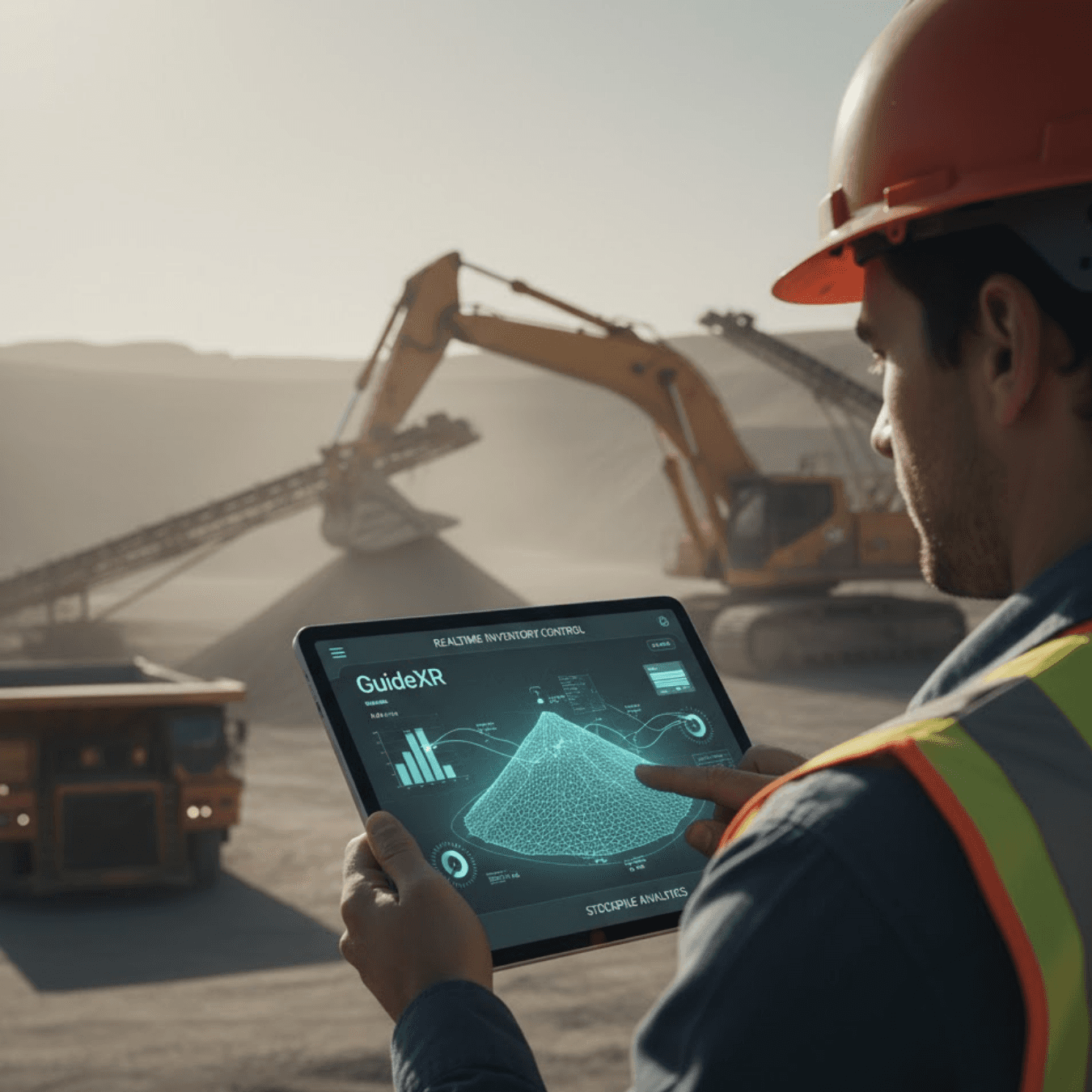
Real-Time Inventory Control

Real-Time Inventory Control

Real-Time Inventory Control

Get live ROM pad and stockyard insights using mobile stockpile measurement technology

Get live ROM pad and stockyard insights using mobile stockpile measurement technology

Field AR surveys provide up-to-date stockpile volume data for accurate inventory visibility

Field AR surveys provide up-to-date stockpile volume data for accurate inventory visibility

Optimize haul-cycle planning and crusher feed scheduling with reliable material insights

Optimize haul-cycle planning and crusher feed scheduling with reliable material insights

AR measurement feature
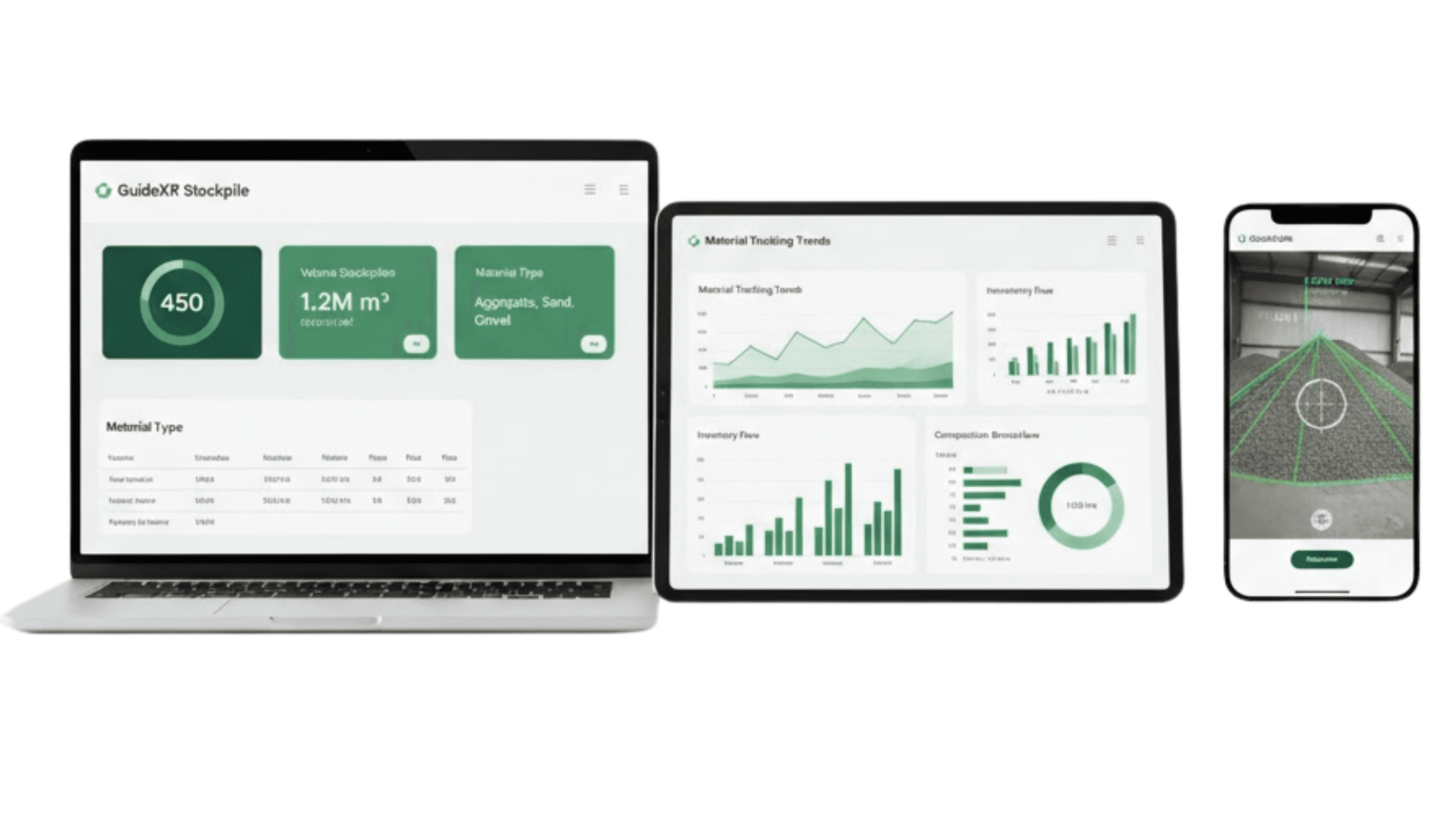
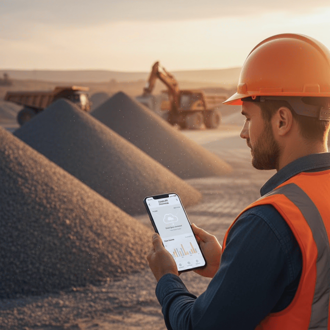
Stockpile inventory management

For Mine Planners & Operations Managers
Significant Time Savings

Significant Time Savings

Significant Time Savings

Modern mobile scanning reduces stockpile survey time to just minutes per pile, not days.

Modern mobile scanning reduces stockpile survey time to just minutes per pile, not days.

AR-based stockpile measurement software cuts field effort by 75–90% compared to legacy survey methods

AR-based stockpile measurement software cuts field effort by 75–90% compared to legacy survey methods

Faster measurements enable planners to adjust production schedules and avoid operational delays

Faster measurements enable planners to adjust production schedules and avoid operational delays

For Mine Planners & Operations Managers
Seamless Reporting & Integration

Seamless Reporting & Integration

Seamless Reporting & Integration

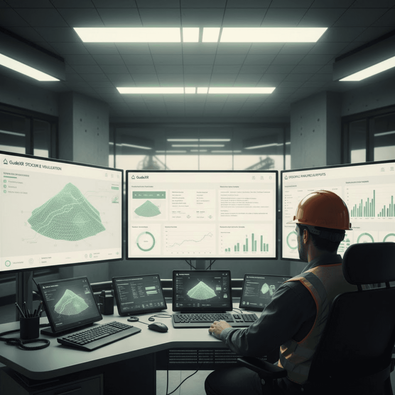
Instantly generate stockpile quantity estimation reports with automated volume-to-tonnage conversion and one-click export to reporting systems.

Instantly generate stockpile quantity estimation reports with automated volume-to-tonnage conversion and one-click export to reporting systems.

Export reconciliation-ready formats, including CSV, GeoJSON, and 3D mesh outputs

Export reconciliation-ready formats, including CSV, GeoJSON, and 3D mesh outputs

Integrate directly with mine planning and reporting systems for streamlined workflows

Integrate directly with mine planning and reporting systems for streamlined workflows

Data export feature
Offline stockpile scanning

For Field Surveyors & Site Teams

Rapid Mobile Stockpile Surveys

Rapid Mobile Stockpile Surveys

Rapid Mobile Stockpile Surveys

Perform full stockpile scans on foot in minutes using a smartphone or tablet

Perform full stockpile scans on foot in minutes using a smartphone or tablet

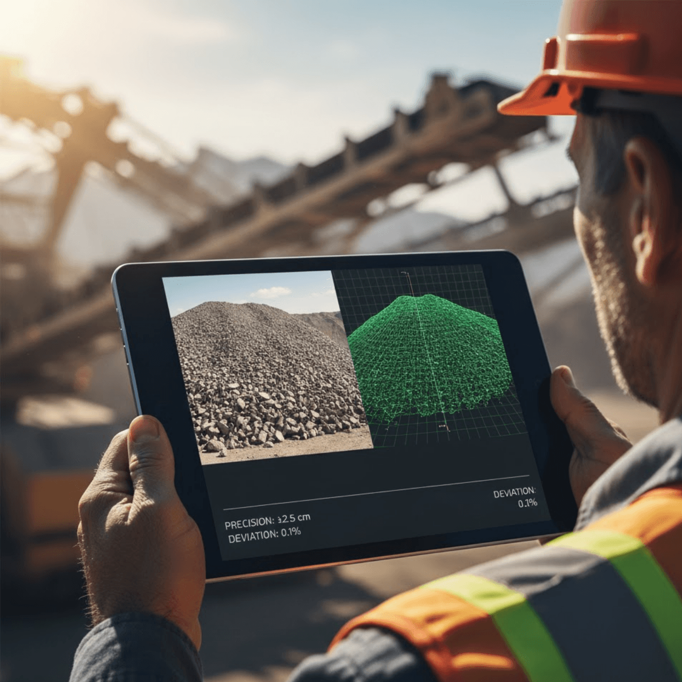
Walk around a pile while GuideXR builds an accurate 3D stockpile model in near real time

Walk around a pile while GuideXR builds an accurate 3D stockpile model in near real time

Update inventory data significantly faster than traditional manual or drone-based survey methods

Update inventory data significantly faster than traditional manual or drone-based survey methods

For Field Surveyors & Site Teams

Survey-Grade Accuracy

Survey-Grade Accuracy

Survey-Grade Accuracy

Capture stockpile geometry with high-precision AR-based measurement technology

Capture stockpile geometry with high-precision AR-based measurement technology

Achieve reliable stockpile volume estimation within ~5–10% variance across operational conditions

Achieve reliable stockpile volume estimation within ~5–10% variance across operational conditions

Generate audit-ready data without climbing hazardous piles or deploying heavy equipment

Generate audit-ready data without climbing hazardous piles or deploying heavy equipment

3D stockpile model
Mobile stockpile measurement

For Field Surveyors & Site Teams

Anywhere Operation

Anywhere Operation

Anywhere Operation

Conduct offline stockpile measurement in remote environments without GPS or network coverage

Conduct offline stockpile measurement in remote environments without GPS or network coverage

Automatically geo-tag and timestamp each scan for compliance, audit readiness, and traceability

Automatically geo-tag and timestamp each scan for compliance, audit readiness, and traceability

Sync stockpile measurement data instantly when connectivity is restored for seamless reporting workflows

Sync stockpile measurement data instantly when connectivity is restored for seamless reporting workflows

Stockpile Measurement Use Cases

Stockpile Measurement Use Cases

Stockpile Measurement Use Cases

Immediate Inventory Updates

Capture every stockyard, ROM pad, blasted bench, or aggregate pile on demand using mobile stockpile measurement technology. Walk around a stockpile while GuideXR builds an accurate 3D mesh in minutes, delivering instant stockpile volume estimation and volume-to-tonnage conversion for improved material balance and operational planning.

Real-Time Material Balance Optimization

Use accurate stockpile volume data to improve dispatch planning and haul-cycle optimization. After blasting operations, planners can verify as-built volumes against design targets to reduce underbreak or overbreak risks and reallocate haul resources based on real-time stockyard conditions.

Stockyard Efficiency & Throughput Optimization

Timely stockpile volume measurement enables planners to identify haul-cycle imbalances and prevent operational bottlenecks. GuideXR Stockpile’s rapid on-site scanning significantly reduces delays in inventory reporting, allowing stockyard counts that once took hours or days to be completed in minutes.

Cost-Effective & Safe Stockpile Measurement

Reduce reliance on costly drone flights and manual survey methods. GuideXR’s handheld AR-based stockpile measurement enables rapid field surveys, often reducing survey time by up to 80–90% for typical stockpiles while maintaining comparable measurement precision and improving operational safety.

Hands-Free Mobile Scanning Workflow

Conduct volumetric surveys without tripods, GNSS rovers, or control points. Simply walk around stockpiles or mined benches while the system automatically generates a detailed 3D stockpile surface model and volume calculation on the device.

Safety-Focused Surveying

Field validation indicates stockpile volume estimation accuracy within ~3–5% of true values, comparable to LiDAR or drone-based survey methods.  Using our GuideXR stockpile measurement app, surveyors remain on stable ground while collecting audit-ready data, reducing exposure to hazardous terrain and improving overall site safety.

Frequently Asked Questions

Frequently Asked Questions

Frequently Asked Questions

What is stockpile measurement?

Stockpile measurement is the process of calculating the volume of materials such as ore, coal, aggregates, or sand stored in stockpiles. GuideXR Stockpile uses mobile AR technology to generate accurate 3D models and estimate stockpile volumes directly from your smartphone.

How accurate is GuideXR Stockpile?

GuideXR Stockpile delivers a typical volume variance of less than 5% under recommended scanning conditions. The app generates detailed 3D models that provide reliable stockpile volume estimates for inventory management and operational planning.

Can GuideXR Stockpile work offline?

Yes. GuideXR Stockpile supports offline stockpile measurement in remote mining and aggregate sites. You can complete scans without network coverage and automatically sync data when connectivity is restored.

Does GuideXR Stockpile require drones or GPS?

No. GuideXR Stockpile performs mobile AR-based stockpile measurement using your smartphone. It does not require drones, GPS equipment, GNSS receivers, or additional survey hardware for typical stockpile surveys.

Which industries use GuideXR Stockpile?

GuideXR Stockpile is designed for mining, quarrying, aggregates, construction materials, and other industries that require fast, accurate stockpile measurement and inventory management.

Is GuideXR Stockpile free to download?

Yes. GuideXR Stockpile is free to download on supported iOS and Android devices. Organizations evaluating enterprise deployments or multi-site rollouts can contact the GuideXR team for additional support and deployment options.

Which devices are supported?

GuideXR Stockpile supports compatible iOS and Android smartphones with AR capabilities. For the best experience, use a device that meets the minimum hardware and operating system requirements listed on the App Store or Google Play.

I have a feature request. Whom should I contact?

We are continuously improving our stockpile measurement software based on user feedback. You can contact the GuideXR team to share feature requests or product suggestions, and our team will get in touch with you shortly.

Can I use GuideXR while operating machinery?

No. For site safety and accurate data capture, the GuideXR app is strictly designed for use on foot during planning activities, or when heavy machinery and equipment are completely stationary.

Transform Your Workforce

Transform Your Workforce

Adopt next-generation stockpile measurement technology to empower teams with faster, safer, and more accurate inventory decisions

Adopt next-generation stockpile measurement technology to empower teams with faster, safer, and more accurate inventory decisions

Adopt next-generation stockpile measurement technology to empower teams with faster, safer, and more accurate inventory decisions

We design human-in-the-loop digital solutions that blend AI, immersive tech, and intelligent systems, built to drive real-world results across operations, training, and customer experience.

Copyright © 2026 Spatial Guide. All Rights Reserved

We design human-in-the-loop digital solutions that blend AI, immersive tech, and intelligent systems, built to drive real-world results across operations, training, and customer experience.

Copyright © 2026 Spatial Guide. All Rights Reserved

We design human-in-the-loop digital solutions that blend AI, immersive tech, and intelligent systems, built to drive real-world results across operations, training, and customer experience.

Copyright © 2026 Spatial Guide. All Rights Reserved

We design human-in-the-loop digital solutions that blend AI, immersive tech, and intelligent systems, built to drive real-world results across operations, training, and customer experience.

Copyright © 2026 Spatial Guide. All Rights Reserved