GuideXR Stockpile is built for remote operations. Capture, process, and verify stockpile volumes in near real-time using just your phone. No GPS, No Drones


Enterprise Ready
GuideXR Stockpile has been independently audited for application security and is built by an ISO 9001 & ISO 27001 certified organization
Realtime Visual Feedback
Location Tagging
90%
Faster Surveys
<5%
Variance
64%
Faster troubleshooting
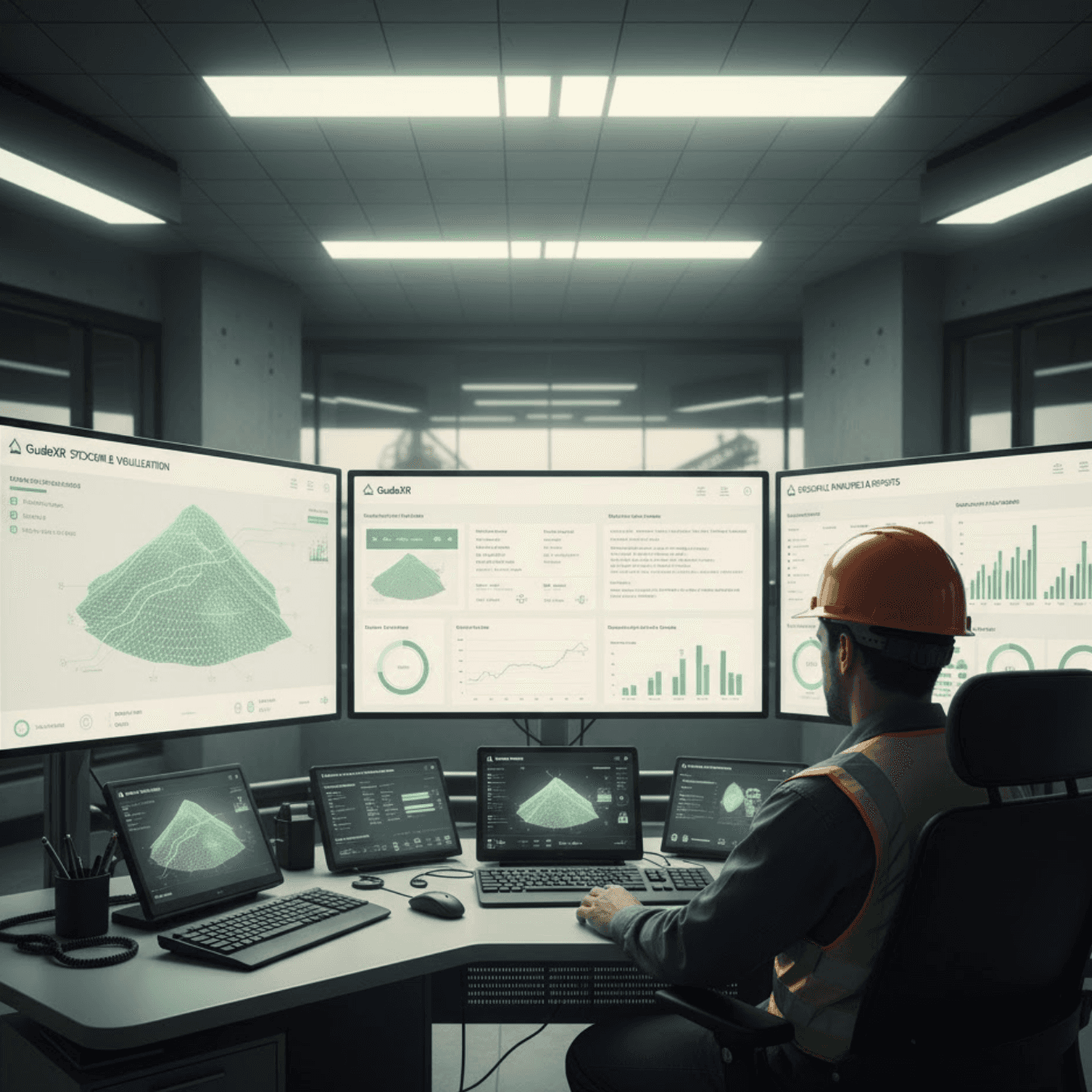
For Mine Planners & Managers
For Mine Planners & Managers
For Mine Planners & Managers
For Field Surveyors & Site Teams
For Field Surveyors & Site Teams
For Mine Planners & Managers
Immediate Inventory Updates
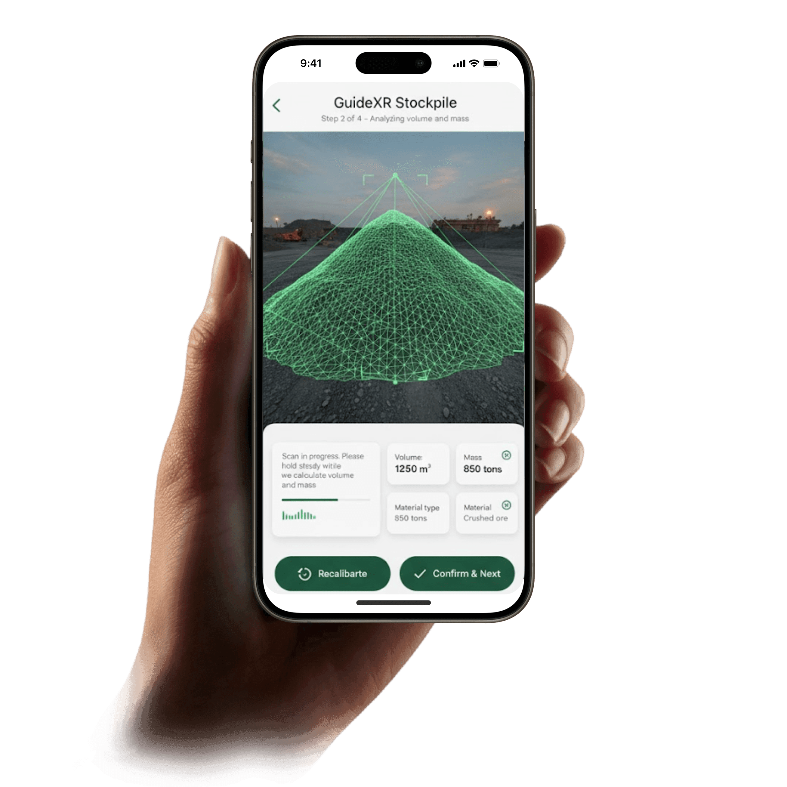
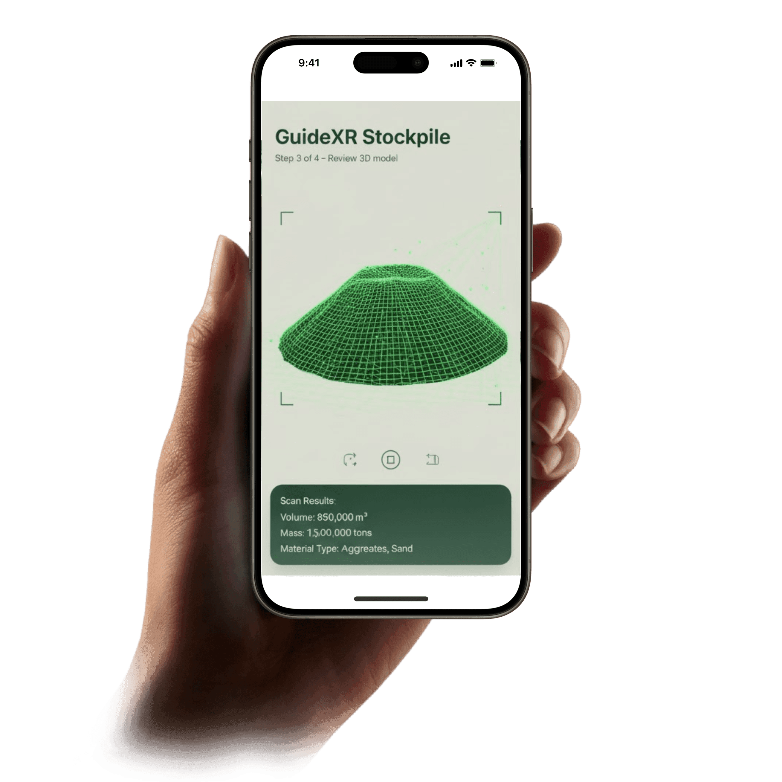
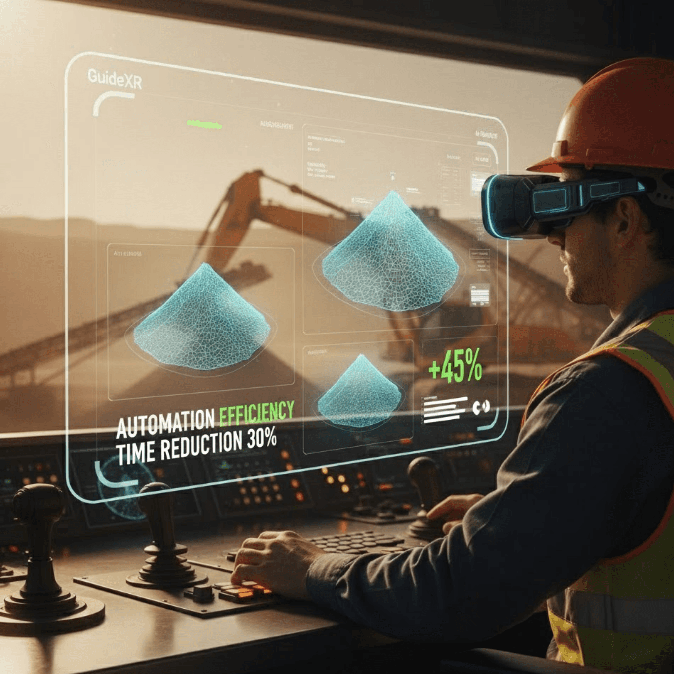
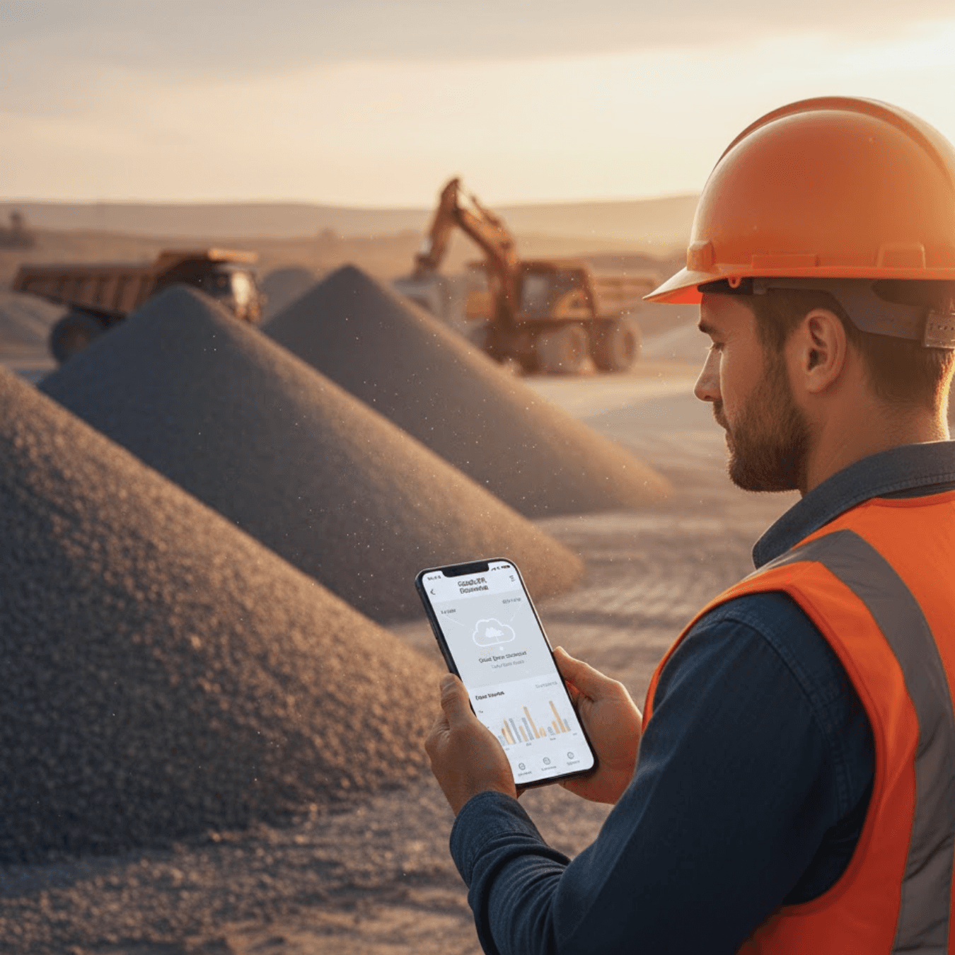
Capture every pile (stockyard, ROM pad, blasted bench, etc.) on-demand. Walk around a stockpile and the app builds a 3D mesh in just a few minutes. Planners get instant volume data (and on-device volume-to-tonnage conversion using site densities) for accurate stockyard reconciliation, material balance, and haul‐cycle optimization.
Real-Time Material Balance
Helps you decide on dispatch plans shift-by-shift. Each scan could directly feed into bench-level planning e.g. after a blast you verify as-built volumes versus design to minimize underbreak/overbreak, or reassign haul resources if the ROM pad is filling faster than expected. Data comes in near-real time so decisions (change the next blast or haul route) are made on current data, not stale estimates.
Stockyard Optimization
Because volume data is timely, you can spot haul-cycle imbalances at once. For example, if stockpile volumes outpace haul schedules, planners reroute trucks or schedule extra loads immediately, preventing bottlenecks. GuideXR Stockpile’s on‑site scans (often completed 90% faster than traditional surveys) remove the lag in inventory reporting, stockyard counts that used to take hours or days now take minutes.
Cost-Effective Safety
Skip costly drone flights or manual surveys. GuideXR runs on handheld AR devices with no extra hardware – reducing survey labor and downtime. In practice, drone and ground surveys can save ~60% in costs compared to ground-only methods, and AR scanning achieves comparable precision without the overhead. All processing happens on device (no cloud needed), so even in remote pits you get a verified report immediately for audit and compliance.
Hands-Free AR Scanning
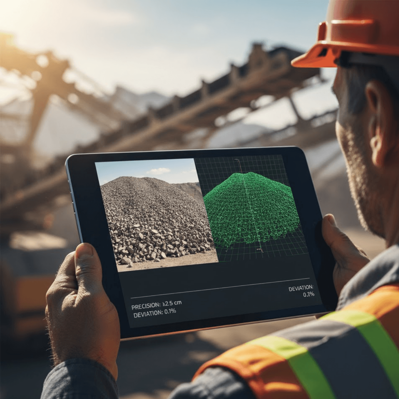
Use any mobile AR device. No tripods, GNSS rover, or control points needed. Simply walk around piles or mined benches; the app auto-stitches the surface into a 3D mesh and computes volume on the spot. This means surveyors can do quick volumetric surveys without waiting for equipment or rover prep.
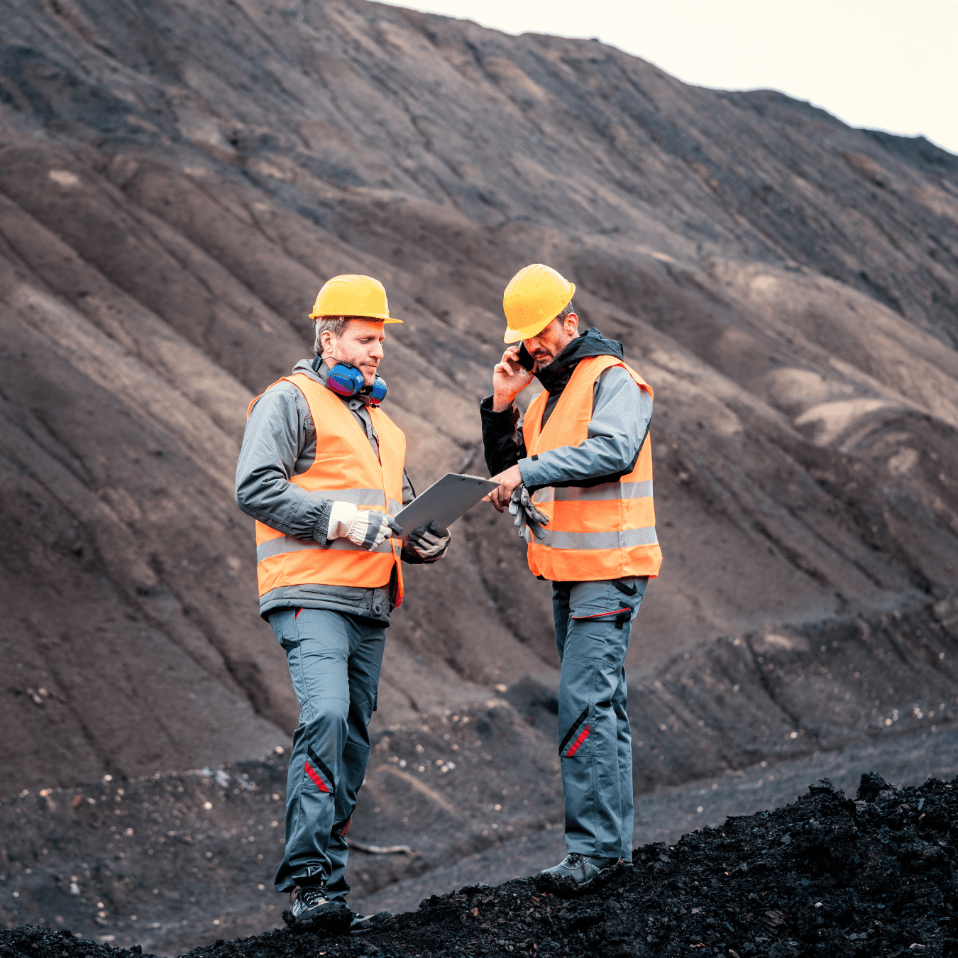
Survey-Grade Accuracy & Safety
Field tests show AR volumes within ~3% of true values are comparable to LiDAR or drone methods. And importantly, crews stay on solid ground. Like drone surveys that “eliminate the need for operators to scale dangerous mounds. GuideXR Stockpile lets surveyors collect data while circumnavigating piles safely at distance (no climbing or string-line needed). Typical piles (several thousand m³) can be scanned in under 10 minutes, slashing survey time by ~80–90%.
I have a feature request. Whom should i share this with?
Lovely! We are constantly looking to improve and enhance the features of the GuideXR app. Email us at contact@spatial.guide. We will get in touch with you.
Do I need to wear a headset?
You dont need to wear a headset to access Guide XR’s AR enabled instruction manuals. You can access them by using the Guide XR app on all compatible IOS devices.
Can I use GuideXR app while working on a machine?
It is recommended that you dont, as this is a mobile based application.However you can use the app for pre-job briefing and as a visual learning aid when a machine is static.
Do I need to be connected to the internet to use the GuideXR app?
Yes, it is recommended that you are connected to the internet while using the GuideXR app.
Do I need special training to create new guides ?
No, you don’t. However you will need to contact your company admin to become a creator on the GuideXR app.